
Region
Panchmahal, eastern Gujarat
Best time
Roughly October to March
Ideal duration
A few hours
Good for
Short walks, ruins, hillside scenery
The Pavagadh slopes are the wooded flanks below the famous summit temple, where the path and the ropeway climb through a mix of forest, rock and scattered monuments. This is the part of the hill many visitors pass through quickly on their way up, yet it holds a good deal of interest if you slow down. Old gateways, tanks and small shrines line the way, remnants of the fortified world that once spread across the hillside.
The gradient here is gentler than the final ascent, and the greenery softens the climb. On a clear day the views open out over the plain and the Champaner ruins below. It is a pleasant zone for a measured walk rather than a hard hike, with plenty of reasons to pause.
What to see and do on the Pavagadh slopes
Look out for the old stone gateways and water tanks set into the hillside, which tell the story of the fortified settlement that once climbed the hill. Several minor shrines and viewpoints make natural stopping points. The forested stretches give welcome shade as you go.
If you are taking the ropeway, you still glide over these slopes and get a fine sense of the terrain. Those walking up can branch off at points to explore quieter corners away from the main pilgrim flow.
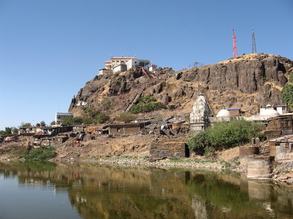
Pavagadh Slopes
How to get there
The slopes are part of Pavagadh hill, reached by road from Vadodara, the nearest major city with air and rail connections. From the base you either walk up through the slopes or take the ropeway, which passes over them. The Champaner ruins nearby make an easy add-on.
Best time to visit
Aim for the cooler months from around October to March, when walking the slopes is comfortable and views are clearest. The monsoon brings lush green but slippery paths, while summer heat makes the open sections tiring.
Good to know
- Wear good shoes; the paths are stony in places.
- Pause at the old gateways and tanks rather than rushing past.
- Carry water, especially if walking rather than riding up.
- Combine with the summit and Champaner ruins for a fuller day.
Frequently asked questions
What are the Pavagadh slopes?
They are the forested lower flanks of Pavagadh hill, threaded with paths, old gateways, tanks and shrines beneath the summit temple.
Are the slopes worth exploring separately?
Yes, if you enjoy history and gentle walking. Many people hurry through, but the ruins and greenery reward a slower pace.
Is walking difficult here?
The lower slopes are gentler than the final climb, making them manageable for most reasonably fit visitors.
The hill below the summit
Most visitors treat Pavagadh as a queue: ropeway up, darshan at the Kalika Mata shrine, ropeway down. The hill's lower and middle slopes — the long green climb the pilgrim path takes — are where the mountain's actual history lives, and they belong to the UNESCO-listed Champaner-Pavagadh Archaeological Park just as much as the ruins on the plain.
Pavagadh is a volcanic hill, its reddish rock rising in tiers, and each tier was fortified and built on. Walking even part of the stepped path threads you through that layering: gateways, walls, tanks and shrines from a thousand years of the hill's use.
What the slopes hold
The path climbs through a sequence of fort gates — the defences of the Chauhan Rajput kingdom that held the hill before 1484, patched and reused by the sultanate after it. Between them lie stepped tanks and reservoirs, the water system that let a hilltop citadel survive sieges; the twin Dudhiya and Chhashiya talavs — the 'milk' and 'buttermilk' tanks — sit high on the shoulder.
The Jain temples of the middle and upper hill are the slopes' finest architecture — a cluster of carved shrines, some dating to the twelfth century, dedicated to the Tirthankaras and still in worship. Below and around them, smaller Hindu shrines, ruined pavilions and sadhus' shelters dot the green — the hill has been sacred a very long time, to several traditions at once.
Walking it
The classic approach: drive or bus to the Manchi plateau partway up, then walk the stepped pilgrim path towards the summit, taking the monuments as they come — or ride the ropeway up and walk selectively down. The full climb from the base is a serious few hours; the Manchi-to-summit stretch with stops is the satisfying middle option.
Wear real shoes, carry water, and start early — the steps are exposed once the sun is up, and the stalls along the path thin out between festival seasons. During Navratri and Chaitra the path is a river of pilgrims; go midweek off-season for the monuments in quiet.
Practical notes
October to March is the comfortable season; the monsoon turns the hill spectacularly green — arguably its most beautiful state — at the cost of slick steps and mist over the views. The slopes are free; the ropeway and summit shrine run their own timings.
Pair the slopes with the Champaner ruins on the plain below — the Jami Masjid above all — and with Jambughoda's forest for a second day. The hill and the city were one capital; seeing both halves is seeing the place whole.